|
|
|
The Fire Danger Index, commonly referred to as the FDI, is a rating system that provides an indication as to the fire risk for a specific area on a specific day. If the expected environmental factors are known for a future period, the FDI can be forecast. Likewise the FDI can be calculated for any present time conditions.
The environmental factors used to calculate the FDI are:
- Temperature: Readings taken in °C
- Relative humidity: The percentage of moisture in the air. The more moisture, the higher the value. 100% RH = mist/rain/fog
- Wind speed: The stronger the wind, the greater the fire risk
- Previous rain: This is tabulated according to when last and how much fell. Expected rainfall is not considered, even if there is certainty it is going occur. This however is countered by the expected Relative Humidity.
All these factors are allocated values, and the total is allocated to a colour coded group:
| |
0 - 20 |
SAFE : Cold and wet |
| |
21 – 45 |
MODERATE : Low fire risk. Care to be taken for burning operations |
| |
46 – 60 |
DANGEROUS : Caution advised |
| |
61 – 75 |
VERY DANGEROUS : Teams kept on standby, no open flames |
| |
76 – 100 |
EXTREME. Warnings presented on radio and TV forecasts |
The Department of Water Affairs and Forestry has produced a document with much more detail for each of the five fire danger rating classes, well worth reading.
So, now that we know all about what factors contribute to calculating the FDI and what the results mean, where would we get the FDI rating for the day from?
The quickest and easiest is from the SA Weather Service website directly. The data they provide is very basic and free. They show a map of the country with the current plus two day FDI rating for all areas, and it is adequate for a decision to burn or not burn your firebreaks.
Then there is a subsciption service available from Vitalfire. For R287.50 they will SMS you two SMSs per day (10h00 and 14h00) for the entire fire season with accurate environmental factor values used to calculate the FDI, the FDI and an FDI forecast for the next 3 days.
Finally, the CSIR provide their amazing AFIS system. It is free but you do have to register so they can create a profile for you. Once you are logged in, the location points you add on their map are added to your profile and display the FDI for your locations. If you click on any of your FDI location pins it provides you with a 10 day FDI forecast with all the environmental factor values used to calculate the FDI for that location. There is also a meteogram graph feature showing a 5 day forecast of temperature, precipitation and cloud cover, and wind speeds, wind gusts and directions for your location. Another map shows current wind direction and wind speeds with a week ahead forecast. The system can be used from the website or you can download the App (free) from the Apple Store or Google Play Store for cell phones.
And if you've got an accurate thermometer, humidity meter (hygrometer), windspeed meter (anemometer) and rain gauge, there are a few FDI calculator Apps available on the Apple Store and Google Play Store that will calculate an FDI rating from the environmental factor values you feed into them from your own instrument readings.
|
|
Advanced
Fire
Information
System |
 |
Safe
(0 - 20) |
We use the
CSIR AFIS system
for Fire Danger
Index (FDI) information.
The logo above
links to the website and the App can
be downloaded
(free) from the
Apple Store or Google Play Store for cell phones. |
;Moderate
(21 - 45) |
Dangerous
(46 - 60) |
Very
Dangerous
(61 - 75) |
Extremely
Dangerous
(76 - 100) |
|
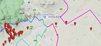
The map logo above
links to Google Maps
with FPA Boundaries and
 all farm numbers overlayed. all farm numbers overlayed.
Website and App
courtesy of Jon Hyde |
|